Soar - The New Atlas
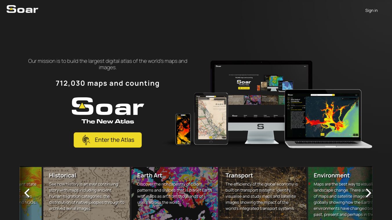
Soar The New Atlas is a cool digital map tool. It wants to be the biggest map collection in the world. It gets maps and satellite pictures from lots of places. Amir Farhand made this tool. It is great for climate scientists, developers, intelligence analysts, mining experts, and defense contractors.
Benefits
Soar The New Atlas has many good things. It has a big collection of maps and images. These include old maps, satellite pictures from places like NASA, and maps from science papers. You can make your own private maps, add your data, or share stuff with everyone. The tool is free, but some parts cost money. It is made for everyone to join in. This means anyone can add and share their maps and images with the world.
The tool is easy to use. You can look at maps and drone pictures using special tabs or by clicking on the map. The tool also helps you add and share your maps easily. The people behind Soar The New Atlas are always making it better. They plan to add a comment system like Reddit and a GeoStore to buy and sell maps and images.
Use Cases
Soar The New Atlas is good for tracking changes around the world. Since anyone can add maps, it has a big collection of map data. Climate scientists can use it to study how the environment changes. Developers can add its data to their apps. Intelligence analysts and defense contractors can use it to plan. Mining experts can look at map data to manage resources.
The big goal of Soar The New Atlas is to be as popular as Google Maps. But it also wants to give more information and let people join in. This makes it a big step for map tools.


Comments
Please log in to post a comment.