GeoTag Buddy

GeoTag Buddy is a user-friendly tool designed to add GPS coordinates and metadata to your images effortlessly. Whether you're working with a single image or a batch, GeoTag Buddy simplifies the process of geotagging, making it easier to organize and enhance your photos. This tool is ideal for anyone looking to add location data to their images, from casual photographers to professionals.
Benefits
GeoTag Buddy offers several key benefits that make it a valuable tool for anyone dealing with images:
- Automatic Location Embedding: Easily embed precise GPS coordinates into your images for accurate location tracking and mapping.
- Enhanced Photo Organization: Make your images discoverable by location, enabling powerful search and organization capabilities.
- Travel Documentation: Perfect for creating detailed travel logs and documenting your journeys.
- Professional Photography Workflows: Streamline your workflow by adding location data to your photos efficiently.
- Social Media Integration: Share your geotagged images on social media with location details, making your posts more engaging.
Use Cases
GeoTag Buddy can be used in various scenarios to enhance your photo management and organization:
- Single Image Geotagging: Upload and geotag one image at a time with custom metadata for each. This feature allows for precise control over individual images, ensuring that each one is tagged with the correct location and relevant metadata.
- Batch Processing: Upload multiple images and apply the same GPS coordinates and metadata to all. This is particularly useful for organizing large collections of photos, such as those taken during a trip or event, ensuring consistency and ease of management.
- Location Tracking: Embed precise GPS coordinates into your images for accurate location tracking and mapping. This feature is essential for creating detailed travel logs, professional photography workflows, and social media integration.
- Enhanced Search: Make your images discoverable by location, enabling powerful search and organization capabilities. This allows you to quickly find and sort images based on where they were taken, making your photo management more efficient.
- Data Analysis: Enable geographic analysis and create location-based insights from your image collections. This can be particularly useful for researchers, photographers, and anyone looking to gain deeper insights from their image data.
Supported Features
GeoTag Buddy supports a range of features to ensure a seamless geotagging experience:
- Multiple image formats (JPEG, PNG, WEBP)
- Precise GPS coordinate input
- Custom keywords and descriptions
- Instant download of geotagged images
- Mobile-friendly interface
How It Works
Using GeoTag Buddy is straightforward and intuitive. Here’s a step-by-step guide to geotagging your images:
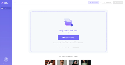
- Upload Your Images: Drag & Drop your images here. Select single or multiple images for batch processing. Use Ctrl+Click for multiple selections.
- Add Coordinates: Enter the latitude and longitude or click on the map to set coordinates.
- Add Metadata: Add keywords or descriptions to your images.
- Generate & Download: Click the button to generate your geotagged images and download them instantly.
GeoTag Buddy is a versatile tool that simplifies the process of adding location data to your images, making it easier to organize, search, and share your photos. Whether you're a casual photographer or a professional, GeoTag Buddy offers the features and functionality you need to enhance your photo management experience.
This content is either user submitted or generated using AI technology (including, but not limited to, Google Gemini API, Llama, Grok, and Mistral), based on automated research and analysis of public data sources from search engines like DuckDuckGo, Google Search, and SearXNG, and directly from the tool's own website and with minimal to no human editing/review. THEJO AI is not affiliated with or endorsed by the AI tools or services mentioned. This is provided for informational and reference purposes only, is not an endorsement or official advice, and may contain inaccuracies or biases. Please verify details with original sources.


Comments
Please log in to post a comment.