GeoSpy.tech – Find Location from Images






What is GeoSpy.tech – Find Location from Images
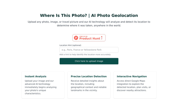
GeoSpy is a smart tool that uses artificial intelligence to guess where a photo was taken. It looks at pictures of buildings, landmarks, and nature to find the country, city, or specific spot. This technology helps people who are curious about the origins of images they see online or in their own collections. It is designed for travelers, researchers, and anyone who wants to learn more about the places in their photos.
Benefits
The main advantage of GeoSpy is its ability to analyze many visual details at once. It does not just look at one thing in the picture. Instead, it studies architectural styles, famous landmarks, natural features, and cultural elements. This approach leads to high accuracy rates. For famous landmarks, the tool is about 95 percent accurate. For major cities, it reaches around 85 percent accuracy. Even for general locations, it can identify the area with about 75 percent accuracy. The system works globally, meaning it can recognize places from anywhere in the world. It also provides confidence scores to show how sure the AI is about its answer. Users get results that include the country, city, and specific landmark names along with map coordinates.
Use Cases
People can use GeoSpy in several different ways. Travelers can use it to remember where they took a photo during their trips. Researchers can use the tool to find the location of historical images for their studies. Curious individuals can upload photos they found on social media to discover where they were taken. The tool works best with clear images that show distinctive features. Users can upload photos of buildings, nature scenes, or street views. If a user knows a little bit about the location, such as the continent or the type of building, they can add that information to help the AI get a better result. The system accepts common image formats like JPG, PNG, and WEBP as long as the file is under 10 megabytes.
Pricing
The provided information does not include specific pricing details for GeoSpy.tech. Users may need to check the official website for current subscription plans or free trial options.
Vibes
The article does not contain specific user reviews, testimonials, or public reception data. However, the tool has demonstrated its capabilities by successfully identifying major landmarks like the Eiffel Tower, the Colosseum, the Taj Mahal, the Statue of Liberty, the Sydney Opera House, and the Great Wall of China. These examples show that the technology is reliable for well-known sites.
Additional Information
GeoSpy uses advanced neural networks to process images. These networks match visual patterns against a large database of global locations. The tool is built to handle a wide variety of image types and lighting conditions. To get the best results, users are advised to use well-lit photos with good resolution. Including distinctive buildings or landmarks in the photo also helps improve the detection accuracy.
This content is either user submitted or generated using AI technology (including, but not limited to, Google Gemini API, Llama, Grok, and Mistral), based on automated research and analysis of public data sources from search engines like DuckDuckGo, Google Search, and SearXNG, and directly from the tool's own website and with minimal to no human editing/review. THEJO AI is not affiliated with or endorsed by the AI tools or services mentioned. This is provided for informational and reference purposes only, is not an endorsement or official advice, and may contain inaccuracies or biases. Please verify details with original sources.




 No Info

Comments
Please log in to post a comment.