GeoAxis
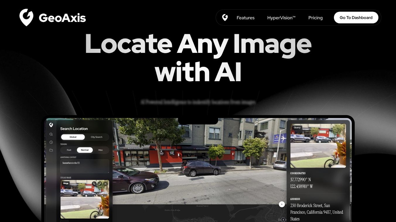
GeoAxis is an AI-powered tool that helps users find the location of people or places by analyzing images. It uses a technology called HyperVision to process photos and determine where they were taken. The platform is designed for legitimate uses such as geospatial research, investigative journalism, and finding missing persons. It is not meant for spying or tracking individuals without their permission.
Benefits
GeoAxis offers several key advantages for its users. First, it provides fast and accurate location data from images without requiring manual review of every query. The system uses automated safeguards to prevent misuse while keeping user privacy intact. Because the technology works behind the scenes, users do not need to worry about their activity being monitored by humans. The tool also includes built-in rate limits to stop automated scraping and mass data collection. This ensures that the platform remains secure and that personal data is not exposed to unauthorized parties. Additionally, GeoAxis encrypts all location results both while they are being sent and when they are stored on servers. This encryption helps protect sensitive information from being intercepted or stolen.
Use Cases
GeoAxis is useful for a variety of professional and personal scenarios. Investigators and journalists can use it to verify the origin of photos in their work. Security analysts might rely on the tool to track movement patterns in a specific area for safety analysis. Families searching for missing persons can use the platform to locate individuals based on images found online. Commercial applications also exist, such as verifying the authenticity of real estate listings or monitoring public events. The tool is strictly prohibited for stalking, harassment, or doxxing, which means it should only be used in ways that respect privacy and follow the law.
Pricing
GeoAxis accepts several payment methods including American Express, Mastercard, PayPal, and Visa. Specific pricing details are not available in the provided information, so users should check the official website for current subscription plans or one-time costs.
Vibes
The public reception of GeoAxis focuses heavily on safety and responsible use. The platform emphasizes a zero-tolerance policy for misuse, with clear consequences for violations such as immediate account suspension and potential legal action. Users are encouraged to report suspicious activity through a dedicated contact channel. The overall vibe is one of caution and responsibility, with a strong commitment to ensuring the technology serves legitimate purposes without causing harm.
Additional Information
GeoAxis was last updated in March 2026. The company states that it does not sell personal data or location information to third parties. All data handling complies with applicable privacy regulations. If a user believes their property appears in location results, they can submit a removal request by providing a valid government-issued ID. The company processes these requests within 5 to 10 business days. GeoAxis also maintains an ongoing commitment to improving its safety measures based on feedback from users and security experts.
This content is either user submitted or generated using AI technology (including, but not limited to, Google Gemini API, Llama, Grok, and Mistral), based on automated research and analysis of public data sources from search engines like DuckDuckGo, Google Search, and SearXNG, and directly from the tool's own website and with minimal to no human editing/review. THEJO AI is not affiliated with or endorsed by the AI tools or services mentioned. This is provided for informational and reference purposes only, is not an endorsement or official advice, and may contain inaccuracies or biases. Please verify details with original sources.


Comments
Please log in to post a comment.